Paypay:Location of Cajamarca Region.png
Waray mas hiruhitaas nga resolusyon.
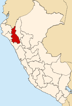
Location_of_Cajamarca_Region.png (238 × 347 nga pixel, kadako han fayl: 25 nga KB, MIME nga tipo: image/png)
Dalikyat nga pulong

|
File:Peru - Cajamarca Department (locator map).svg is a vector version of this file. It should be used in place of this PNG file when not inferior.
File:Location of Cajamarca Region.png → File:Peru - Cajamarca Department (locator map).svg
For more information, see Help:SVG. |
.svg) |
| Tigtulidong | Map showing the location of the Cajamarca region in Peru |
| Petsa | |
| Ginkuhaan | Kalugaringon nga buhat |
| Awtor | AgainErick |
Palilisensya:
| I, the copyright holder of this work, release this work into the public domain. This applies worldwide. In some countries this may not be legally possible; if so: I grant anyone the right to use this work for any purpose, without any conditions, unless such conditions are required by law. |
Kaagi han paypay
Pidlita an adlaw/oras para makit-an an fayl nga naggawas hito nga oras.
| Pitsa/Oras | Thumbnail | Mga dimensyon | Gumaramit | Komento | |
|---|---|---|---|---|---|
| waray pa kasasapawi | 20:39, 12 Agosto 2007 | | 238 × 347 (25 nga KB) | AgainErick | {{Information |Description=Map showing the location of the Cajamarca region in Peru |Source=self-made |Date=August 12, 2007 |Author= Eric Bronder }} Cajamarca |
Mga Sumpay
An mga nasunod nga mga pakli nasumpay hini nga paypay:
Global file usage
An masunod nga iba nga mga wiki in nagamit hini nga file:
- Paggamit ha ba.wiki.x.io
- Paggamit ha en.wiki.x.io
- Department of Cajamarca
- Celendín
- Cajamarca Province
- San Pablo Province
- Jaén Province, Peru
- Cajabamba Province
- Celendín Province
- San Miguel Province
- San Marcos Province
- Hualgayoc Province
- Chota Province
- Contumazá Province
- San Benito, Peru
- Cachachi District
- Cajabamba District
- Condebamba District
- Sitacocha District
- Celendín District
- Chumuch District
- Cortegana District
- Huasmín District
- Jorge Chávez District
- José Gálvez District
- Miguel Iglesias District
- Oxamarca District
- Sorochuco District
- Utco District
- La Libertad de Pallán District
- Sucre District, Cajamarca
- Anguía District
- Chadín District
- Chiguirip District
- Chimbán District
- Choropampa District
- Cochabamba District, Chota
- Conchán District
- Huambos District
- Lajas District
- Llama District, Chota
- Miracosta District
- Paccha District, Chota
- Pión District
- Querocoto District
- San Juan de Licupis District
- Tacabamba District
- Tocmoche District
- Chalamarca District
- Chilete District
- Contumazá District
Kitaa durudamo nga global usage hinin nga file.